views
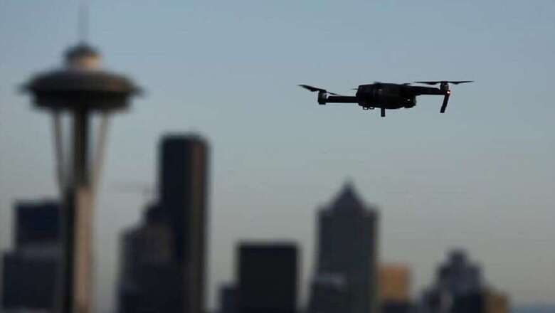
Companies like Amazon have big ideas for drones that can deliver packages right to your door and a new mapping system developed by researchers at Massachusetts Institute of Technology (MIT) can help achieve that. The new system, called NanoMap, allows drones to consistently fly 32 km per hour through dense environments like forests, the researchers said.
Being able to avoid obstacles while travelling at high speeds is computationally complex, especially for small drones that are limited in how much they can carry on-board for real-time processing. The new system considers the drone’s position in the world over time to be uncertain and actually models and accounts for that uncertainty.
“Overly confident maps won’t help you if you want drones that can operate at higher speeds in human environments," said Pete Florence, lead author on a new related paper. “An approach that is better aware of uncertainty gets us a much higher level of reliability in terms of being able to fly in close quarters and avoid obstacles," Florence added.
Specifically, NanoMap uses a depth-sensing system to stitch together a series of measurements about the drone’s immediate surroundings, according to the study to be presented at the IEEE International Conference on Robotics and Automation (ICRA), scheduled in May in Brisbane. This allows it to not only make motion plans for its current field of view but also anticipate how it should move around in the hidden fields of view that it has already seen.
Also read: Xiaomi Mi TV Expected to be Launched Alongside Redmi Note Successor on Feb 14
“It’s kind of like saving all of the images you’ve seen of the world as a big tape in your head," Florence said. “For the drone to plan motions, it essentially goes back into time to think individually of all the different places that it was in," he added.
The team’s tests demonstrated the impact of uncertainty.
For example, if NanoMap was not modelling uncertainty and the drone drifted just five percent away from where it was expected to be, the drone would crash more than once every four flights. Meanwhile, when it accounted for uncertainty, the crash rate reduced to two percent.
The team believes that the system could be used in fields ranging from search-and-rescue and defence to package delivery and entertainment and can also be applied to self-driving cars and other forms of autonomous navigation.
Watch: Sonam Wangchuk, Engineer And Education Reformist | Interview


Comments
0 comment